 |
|
|
|
|
|
|
|
|
|
|
|
|
|
|
|
|
|
|
|
|
|
|
|
|
 |
Last updated: 24/05/22 |
|
Hill of Cat Day Meet 11 Oct, 2020 |
|
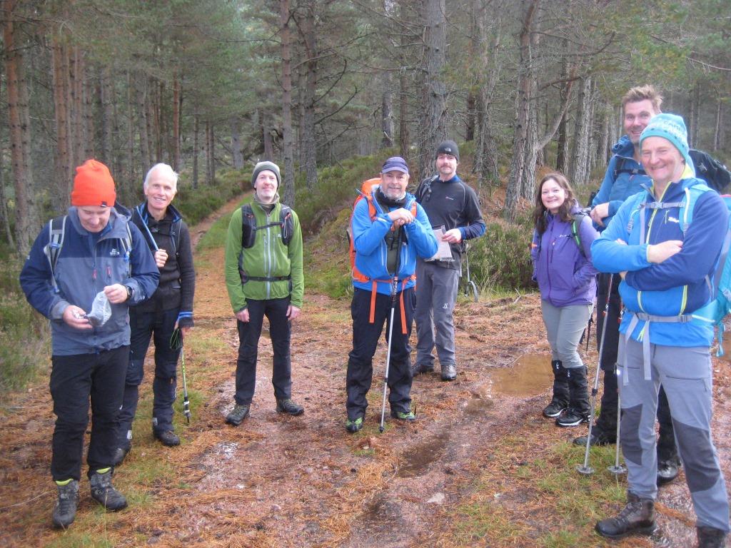
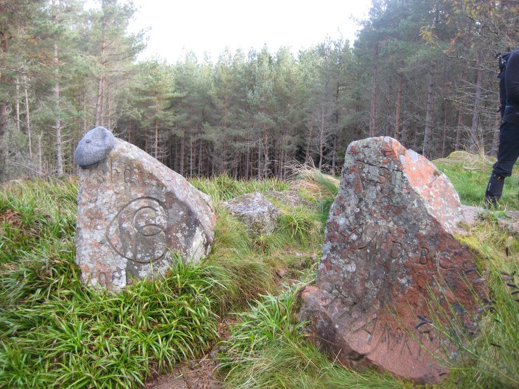
Club members of previous generations would have considered 9:30am as a disgracefully late start for a Club meet, but the travel constraints of Covid-19 put us at the mercy of the Stagecoach 201 service, which landed Alex and Mike at Aboyne at 9:25, to join the rest of us (about 10 in number) who had arrived in separate cars. Booted and spurred, we set off over the bridge to the start of the Fungle Road (meaning unknown: though the 1:25000 map shows “The Fungle” as the gorge about halfway up to the house marked as “The Guard”). All amenities in this area are due to the banker and politician Sir William Cunliffe Brooks, who “lavished money on Glen Tanar, building a large house, cottages for estate workers, a school, stables and kennels”, and “installed numerous carved stones and memorials in the surrounding countryside, many of which make playful references to his name or celebrate the virtues of drinking water rather than alcohol”. In 1905, the estate was bought by the Paisley-based textile manufacturer George Coats, who later became Lord Glentanar; the present owners are his descendants Michael and Claire Bruce. One or two early junctions to be negotiated, but soon heading steeply uphill through the trees, but a short rest at the Rest and Be Thankful (where a Harris Tweed cap adorned one of the carved stones: later collected by its owner after 5 days in situ, according to Anne!).
As the ground flattened out, with bracken amongst the more scattered trees, we were mown down by a couple of bikers, but made it for a coffee stop in a borrow pit below Carnferg (meaning the hill of St Fergus, of anger, or of grouse: take your pick!).
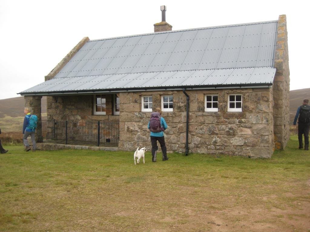
From now on, it was fairly monotonic landrover track, over the headwater of the Burn of Aultgarney, past a very posh bothy,
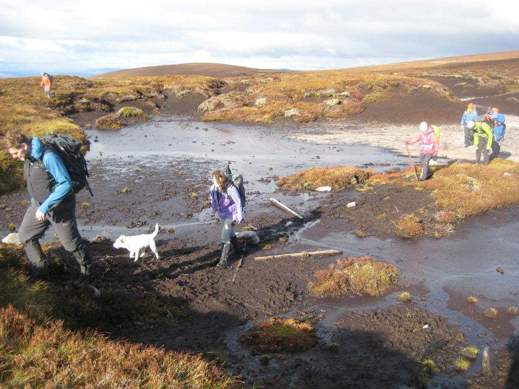
and a sharp right – at a good view down into the gorge of the Burn, with the steep “Gwaves” (“trench”) hillside on the other side - to ascend the “Hard Shouther” (1:25000 map again) to (more or less) the Hill of Duchery (Dubh choire or “black corrie”, i.e. overgrown with heather, which it certainly is). Grouse – survivors, presumably – about. A track gap on the map became explained by a boggy section leading over to the ridge of Craigmahandle, below which we stopped, in somewhat meagre shelter from the breeze, to enjoy lunch with a good view east as far as Clachnaben beyond Mount Battock.
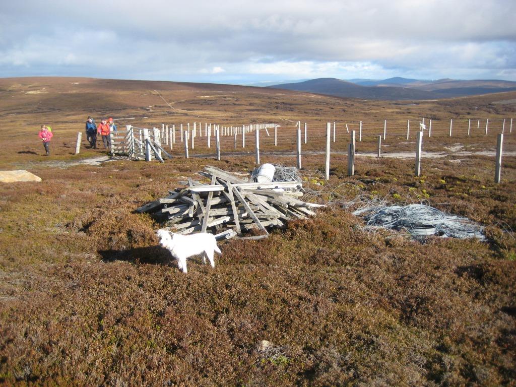
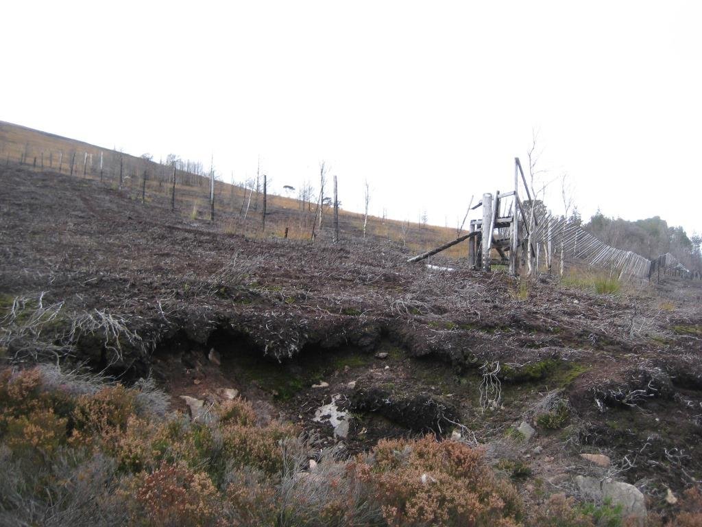
Girding up our loins again, we reached the Firmounth Road track, which leads up to near the summit of Craigmahandle but, rather more spectacularly, is adorned with a National Nature Reserve sign, a very fine C19 gate in the now-minimalist fence, and a modern “Welcome to the Moor” sign located here for no obvious reason. On past the Hill of St. Colm on our right (where a RAF Vulcan crashed in 1963 with 5 fatalities; little wreckage now remains), to ascend the Gannoch (“sandy”) hill, to the distress of those who wished to see St. (Mal?)Colm’s Well (with carved stone?) now on our right. Some discussion here as to whether the Hill of Cat (the advertised goal of the Meet) was within our range, and if so how would we get back, but all (especially Millie the Dog, but perhaps not the Meet Organiser) seemed keen on bagging it, so we proceeded SW, to meet both industrial grouse moor (double electric fencing, a fancy modern gate, landrover motorway on our left) and a stretch of good old peat haggs, with residual C19 fence posts stuck into a convenient string of boulders which seemed to have surfaced through the glaur at just the right intervals. Some of the blacker bits deserved caution in case of sinking in up to one’s oxters, but most turned out to be drier than they looked.
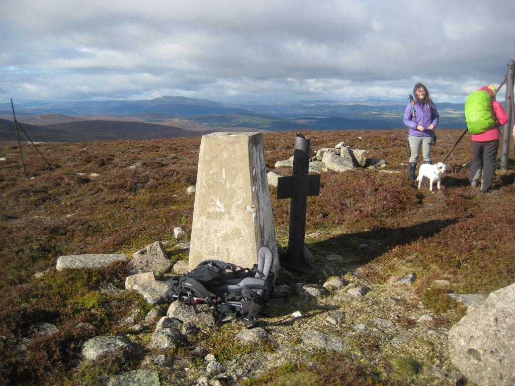
And so to the trig point of the Hill of Cat (no translation needed?) with next to it a well-formed cross (and a previous trig pillar, now fallen; I wonder when and how it was destroyed, and when they replaced it). The cross turned out to be yet another piece of C19 fencing, not a memorial to an exhausted hillwalker or an accidently targeted grouse-slaughterer: the amount of metal hauled up to these heights invites astonishment.
Anyway, another stop to celebrate this summit (the word is used advisedly) of 742m, before we plunged down through deepish heather, past a small well-formed but now roofless stone shelter, to a track going down to the Water of Allachy (Allt ruadh, or red burn).
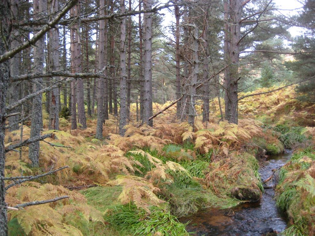
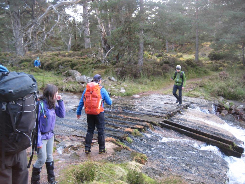
It might have been quicker, and more pleasant, to have headed straight down a gully in the West Grains (“branches”) of Allachy to a lower and grassier track, but … Now out of the wind and on the level, but with time pressing, we accompanied the water northwards, passing the site of a fire amongst the first trees of the NNR. I would have dated fairly recently but which apparently occurred in 2018 as a result of an estate training exercise(!): see parkswatchscotland.co.uk/2018/06/11/glen-tanar-fire/. Then fine old pinewoods, to a metalled ford (an "Irish bridge"?) across the Allachy and up(!) 50m in height to the Firmounth Road which was angling down above us.
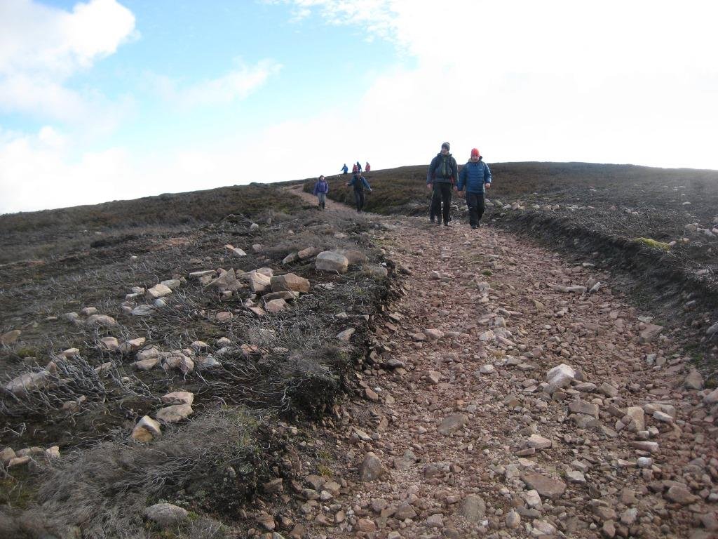
Then (more of) The Long Walk Out, past a “view”, a fenced tree, and even a few people (the first seen all day after the bikers) near the car park in Glen Tanar (variously Tana circa 1900, Taner 1654, Taner 1649, Tawner, 1594, Tannyr or Tanyr, 1450; “No satisfactory explanation of the name has been offered, and it may be Pictish, while it is possible Taner may have been a personal name”). We kept right, past the Fairy Loch, all the way down to the Bridge of Ess on the South Deeside Road. A final slog along the tarmac in the gathering darkness, past an “Honest Water” trough, to Aboyne, where the lights of the Boat Inn attracted, even with outdoor drinking. But time was running out, especially for the bus-riders, so we just headed for the cars, after 9 and a half hours on the hoof, and, according to the step-counters, some 30-odd kilometres to our credit. Thanks to Garry for organising, and congratulations to all, especially a small dog, who completed the day.
|
|
Author - Ken Thomson Photos - Ken Thomson |